
Planning Commission Continues Refinement of Potential Boundary
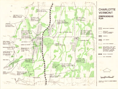
East Charlotte Village proposed boundary.
The Thursday, April 4 Planning Commission meeting focused once again on the East Charlotte Village District boundary and Charlotte land use regulations, as was proposed during the March 21 meeting. The commission’s goals were to analyze possible development maps, hear public comment, and figure out the finer points of LURs and boundary issues. Attendance was lower at this meeting, with about four members of the public in attendance, as opposed to the previous meeting which had almost 20 concerned Charlotters.
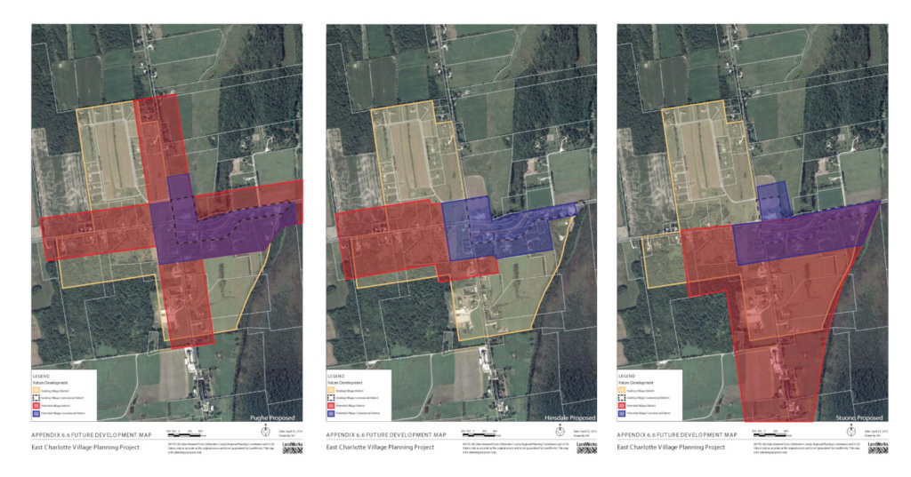
Chair Peter Joslin opened the discussion reviewing the Planning Commission’s work since the last public meeting, which included “putting together a proposed map for the village district, and village district commercial boundaries, based on the three maps received by the commission, and taking into consideration input from the public at three previous meetings.” The commission went through three proposed future development maps with an eye to boundary details, asking questions about the inclusion of lots that are currently conserved under open space agreements and land already commercially zoned.
Planning Commission Vice Chair Charlie Pughe and the developer of the ECV project Clark Hinsdale III were present to discuss their maps. Residents Bill Stuono and Sarah Thompson submitted written comments to the commission regarding concerns about traffic and housing density, among other issues. First the commission reviewed the potential village commercial boundaries, outlined in blue, and then reviewed the potential village boundaries in red (see maps with this story). After some discussion it was agreed that part of the blue outline in the northwest quadrant on the “Pughe Proposed” map would be removed. The southwestern outlines near the existing village boundaries elicited more discussion as it was unclear how the lines were drawn. Hinsdale asked the commission to “go with parcel lines as much as possible,” and Pughe agreed, saying, “either parcel lines or natural features.”
Review of the potential village boundaries prompted similar feedback, with Fisher also requesting the board to consider “following lot lines where possible.” The commission also discussed growth and density. Member Marty Illick asked about possible build outs: “We could get upwards of 60, currently without changing anything. The large part of the map is for traffic calming. Beyond that, what more do we want to do get the density we desire?” Joslin replied, “We are trying to encourage growth and being able to build houses that are not quite as expensive. We still need to have the density.”
As the agenda item wound to a close, Town Planner Daryl Beniot responded to a question from Shawn Coyle about traffic calming. He recommend a traffic study be conducted at the Spear Street and Hinesburg Road intersection, citing his experience with traffic-calming measures implemented on Harbor Road in Shelburne. “You could have a significant reduction in speed,” he said. Joslin concluded that there “was pretty good agreement” of the potential village commercial district boundary. He said that the next step is drawing the boundaries in more detail and presenting at the April 8 meeting at 8:00 p.m.
In other Planning Commission business, Joslin asked if a member of the commission would be willing to volunteer as part of a West Village parking and road development subcommittee. It will include Selectboard Vice Chair Frank Tenney and representatives from Charlotte Volunteer Fire and Rescue Services, the Charlotte Library, Senior Center, Children’s Center and the Health Center. Coyle volunteered to represent the Planning Commission at the subcommittee.
Related Stories

Popular Stories
If you enjoy The Charlotte News, please consider making a donation. Your gift will help us produce more stories like this. The majority of our budget comes from charitable contributions. Your gift helps sustain The Charlotte News, keeping it a free service for everyone in town. Thank you.
Andrew Zehner, Board Chair